Possibly the least known mountain range in southwest Montana, the John Long Range, is a special area for those seeking peace and isolation from the noise of modern life.
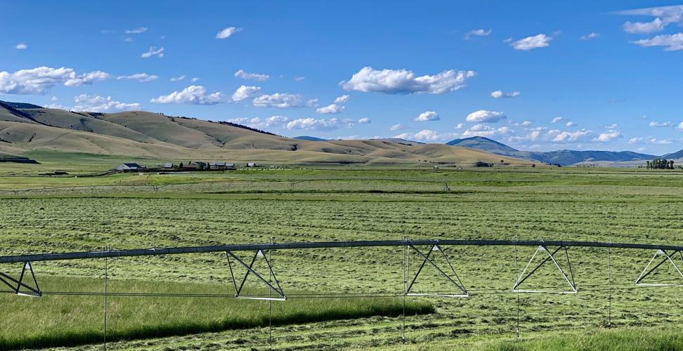
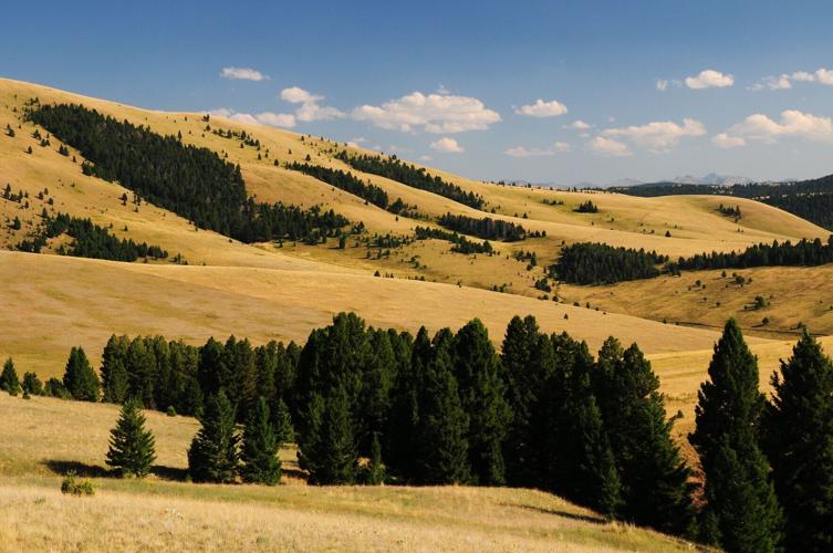
Possibly the least known mountain range in southwest Montana, the John Long Range is a special area for those seeking peace and isolation from the noise of modern life. Many people mistakenly believe it is part of the Sapphire Range when the John Longs are in fact its own distinct mountain grouping. Extensive roadless areas, low elevation, forest covered mountains, and lack of any nearby population center are their defining features.
Rock Creek, renowned for its blue-ribbon trout and sapphires, is the dividing landmark between the John Longs and the Sapphires. On its eastern flank, Flint Creek and the Flint Creek Valley separate the John Longs from the more prominent and rocky Flint Creek Range. The Clark Fork River, from its confluence with Rock Creek, serves as the northern perimeter eastward to the Flint Creek Valley. Highway 38, the Skalkaho Road, is the southern edge.
John Long, a popular mining foreman from Philipsburg who lived in the area in the late 1800s, had the honor of having these mountains named after him.
While on the surface they appear unremarkable, the mountains provide outdoor recreationalists access to a truly wild and natural area left mostly undisturbed from human development. In the northern areas of the range, there is a sizable and healthy elk herd as well as a wolf pack. Along Rock Creek, bighorn sheep are frequently seen and photographed at the 8,000-acre Babcock Mountain Bighorn Sheep Viewing Area.
On the eastern flank, Flint Creek and the Flint Creek Valley separate the John Long Mountains from the more prominent and rocky Flint Creek Range.
RICK & SUSIE GRAETZ, University of Montana
Even with ample wildlife, hunting is not popular in the region because private land restricts access to the areas where wildlife frequent.
Quigg Peak, 8,419 feet, and Butte Cabin Ridge, 8,468 feet, are the tallest points in the range.
Arguably the best way to experience the John Longs is to drive along the arduous 42-mile Rock Creek Road. This passage follows the Rock Creek from its confluence with the Clark Fork River to Montana Highway 348. It is well known by locals to be narrow and in dire need of maintenance. Be prepared to have to reverse and maneuver to let incoming traffic pass.
If you travel south on Rock Creek Road, the first major stop is the scenic Valley of the Moon. It holds many wetlands and is a favorite fishing spot for anglers. A bit further south is the Babcock Mountain Bighorn Sheep viewing area and Babcock Mountain trailhead.
From here, road conditions begin to deteriorate with cabins becoming less frequent. Numerous small first-come, first-serve campgrounds, like Norton campground, Grizzly campground, Welcome Creek campground and Dalles campground, are available. Many trailheads along the way provide access to the wild country and the peaks that rise from the eastern side of the valley that allows experienced hikers to summit both Quigg Peak and Butte Cabin Ridge. Many hikers agree that the best trek is Sandstone Ridge. It is long, dry, but has great views. The hike is best experienced as a backpacking trip and is accessible from Brewster Creek from the North and Sandstone Ridge trailhead on the southern end of the range.
A bit further south of the Butte Cabin trailhead is the Bitterroot Flat campground and an informational roadside sign about the Rock Creek Microburst where weather conditions generated 150 mph winds that handedly knocked over century-old trees. After the sign there are three more campgrounds and two abandoned homestead cabins, the Hogback and Morgan-Case homesteads.
From here until its end at Montana Highway 38, the valley widens, and vacation cabins dot the landscape. A few miles west of the intersection of Rock Creek Road and Highway 38 is the Gem Mountain Mine where visitors can try their luck at sifting through gravel to find sapphires.
Although mining was not an activity of note in the John Longs, one bit of history is worth noting.
Possibly the least known mountain range in southwest Montana, the John Long Range, is a special area for those seeking peace and isolation from the noise of modern life.
RICK & SUSIE GRAETZ, University of Montana
Quiggly, about 15 miles south of Clinton, is the only named community along Rock Creek. While it might not show any evidence of it today, the confluence of Brewster Creek and Rock Creek was once home to roughly 2,000 people who came to the area to prospect for gold in 1895. So much attention was on the Quiggly area that President Grover Cleveland and investors from the East Coast invested money in the burgeoning mining town. An aqueduct and railroad were proposed to be built but never were completed. By 1896, it became clear that reports of gold in the area were unfounded as the mines produced little to no gold. Today, nothing remains of the downtown that grew with the mining camp.
Three USFS cabins in the John Long are available for rental; they are Morgan-Case Homestead, Hogback Homestead and Stony Creek Guard Station. Moose Lake Guard Station and West Fort Rock Cabin are nearby, but not technically in the John Longs. To reserve use, recreation.com.
Thanks to Josh Lattin of the USFS Pintler Ranger Station in Philipsburg, Montana, for his assistance in gathering information for this profile.
Editor's note: The University of Montana's Office of Research & Creative Scholarship along with the Davidson Honors College have produced a series of stories called the "This Is Montana Community Vitality Program." In partnership with the program, Lee Newspapers will be regularly running their Treasure State treasure trove of stories.
Keep it Clean. Please avoid obscene, vulgar, lewd,
racist or sexually-oriented language. PLEASE TURN OFF YOUR CAPS LOCK. Don't Threaten. Threats of harming another
person will not be tolerated. Be Truthful. Don't knowingly lie about anyone
or anything. Be Nice. No racism, sexism or any sort of -ism
that is degrading to another person. Be Proactive. Use the 'Report' link on
each comment to let us know of abusive posts. Share with Us. We'd love to hear eyewitness
accounts, the history behind an article.






(0) comments
Welcome to the discussion.
Log In
Keep it Clean. Please avoid obscene, vulgar, lewd, racist or sexually-oriented language.
PLEASE TURN OFF YOUR CAPS LOCK.
Don't Threaten. Threats of harming another person will not be tolerated.
Be Truthful. Don't knowingly lie about anyone or anything.
Be Nice. No racism, sexism or any sort of -ism that is degrading to another person.
Be Proactive. Use the 'Report' link on each comment to let us know of abusive posts.
Share with Us. We'd love to hear eyewitness accounts, the history behind an article.